School Travel
We are committed to encouraging all of our pupils and their parents or carers to walk to and from school, at every opportunity.
Travelling to and from school is something we all do 10 times each week, 38 weeks a year. That's a total of 380 journeys every year! Multiply that by the 800 children we have at Ashton Gate and you realise that we are having a huge impact on traffic in and around the local area.
At Ashton Gate, we want everyone to support us to make these journeys as safe, healthy and sustainable as we can.
School Street
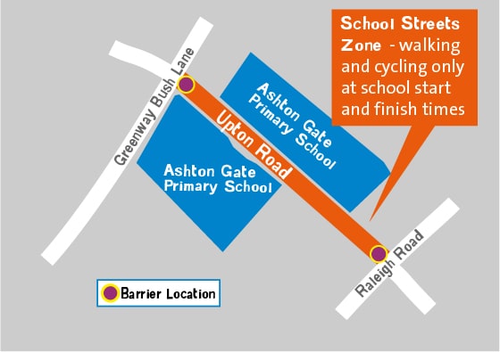
The Ashton Gate Primary School Street launched on Upton Road 21st October 2024. The main aims of School Streets are to:
- lower the volume of traffic around the school gates
- improve road safety for pupils and their families
- encourage more pupils to walk, wheel, cycle or scoot to school
- improve the air quality and environment at the school gates, making it a more pleasant space for everyone

To reduce traffic danger and congestion in the area, Bristol City Council has turned a section of Upton Road into a walking, wheeling, cycling and scooting-only zone at school start and finish times.
Vehicles are not permitted to enter the zone for 45 minutes in the morning between 8.15am and 9.00am and 45 minutes in the afternoon between 2.45pm and 3.30pm. Emergency vehicles, Blue Badge holders and Upton Road residents are exempt from these restrictions.
What is a School Travel Plan?
A School Travel Plan (STP) is a document which sets out how a school will promote safe, active and sustainable travel to school. The main emphasis is put on reducing car use on the school journey. For a STP to be successful it must be supported by the whole school community e.g. pupils, parents, teachers, governors and the local community. Our STP Leader is Donna Scriven.
We have a number of initiatives in place which support our STP. Our school Active Travel policy is below.
Parking
We encourage parents not to park on Ashton Gate Road during drop-off and pick-up. There are parking bays on both Greenway Bush Lane and Raleigh Road that can be used for free for up to 30 minutes or use the Park and Stride parking in Aldi.
Please do not park or stop on the yellow zig zags outside the school buildings or on double-yellow lines. Parking on yellow lines outside schools and in local roads means that views are blocked for drivers and pedestrians - especially children. Please help us keep our children safe by parking responsibly.
Park and Stride
Aldi on North Street kindly allow our parents to park in their car park for drop-off and pick-up.
We encourage parents to use this option rather than trying to park close to the school so that children can still get active for part of their journey, whilst reducing the congestion and air pollution around the school gates.
Park and Stride/Road Crossing Patrol Map

School Crossing Patrol
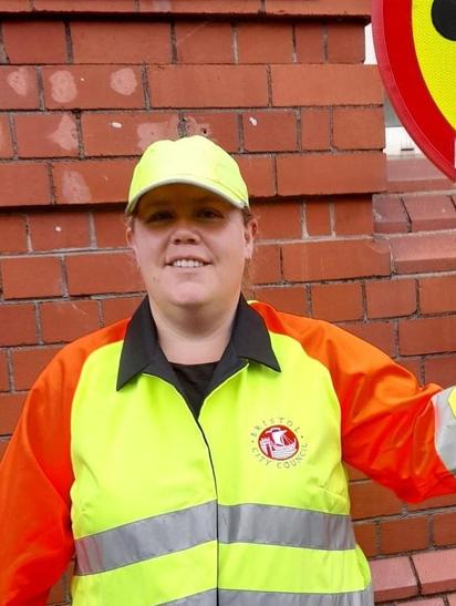
We are very lucky that we have a Crossing Patrol Officer at the school on Raleigh Road, both before and after school. Please make use of this crossing patrol to ensure that you and your family cross the road safely.
Lilly Crofts - School Crossing Patrol

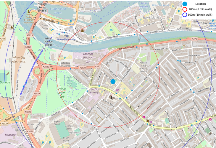
5 & 10 minute walk to school map

Modeshift STARS
We currently hold a Good accreditation with Modeshift STARS (a national awards scheme) as recognition for demonstrating excellence in supporting cycling, walking and other forms of sustainable travel to school. This was awarded in January 2025. We continue to work hard to improve our initiatives to further promote safe and active travel within our school community.

Public Transport
If you need to access public transport, please find details below for the local bus company (First Bus):
Bristol, Bath and the West | First Bus
Bristol Clean Air Zone
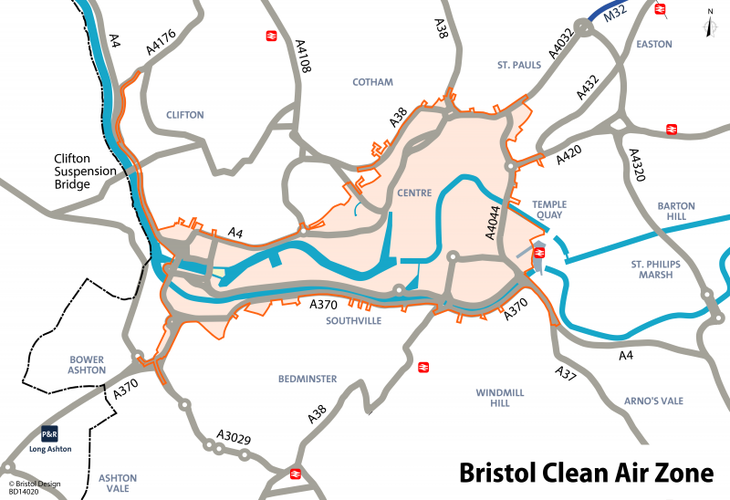
Bristol’s Clean Air Zone (CAZ) started on Monday, 28 November 2022. The zone will help improve air quality by reducing harmful levels of air pollution caused by traffic. It will also help make sure everyone in Bristol benefits from a healthy and natural environment.
A daily charge will apply to older and more polluting vehicles driving in the zone. This will be reinvested back into the local community, supporting individuals and businesses to switch to cleaner vehicles, ongoing work to make it easier to walk and cycle, and the introduction of green public transport.
The maps below show the CAZ and a more detailed view of the proximity to the school.


